Move geodata intelligently
Spatial Manager
Compatibility
Spatial Manager™ – a geodata plug-in that simplifies importing, exporting, transforming and managing spatial data in BricsCAD®, ZWCAD® and AutoCAD®.
Spatial Manager
For which customers?
Planners, municipalities and utilities who import geodata into their CAD, transform it and export it again.
- Geodata import/export
- Coordinate transformation
- Background maps
Spatial Manager
Highlights
Data export
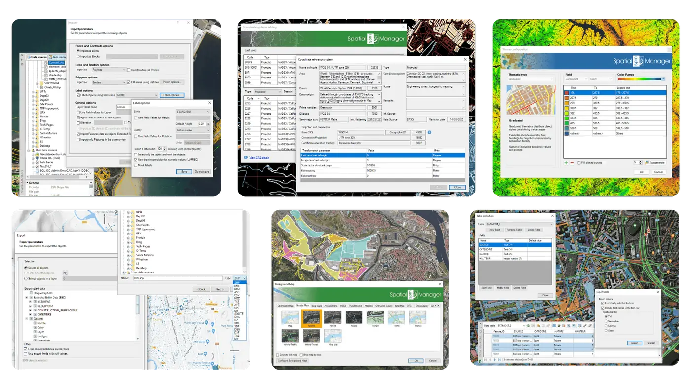
Export objects from BricsCAD to geo files or databases and save their extended entity data (EED) as alphanumeric data tables.
Data import
Imports spatial data into new or existing BricsCAD drawings as BricsCAD objects and extended entity data (EED).
Spatial Manager
Features
Publishing to Google Earth
Export all or some of the objects on visible layers from BricsCAD, together with their data, to a KML or KMZ file.
Background maps
Choose from a wide range of dynamic background maps such as Google Maps, OpenStreetMap or Ordnance Survey, configure your own maps from TMS, WMS or WMTS servers, or connect to Cloud Optimised GeoTIFF (COG TIFF) sources.
Coordinate transformation
Calculates the geometric transformation of objects during import and export in BricsCAD.
Cross-selling for your customers
Works well with Spatial Manager
 BricsCADAny customer working DWG-based in 2D and 3D – from design offices to mechanical engineering. Ideal for users switching from AutoCAD®.CAD platform →
 GeoToolsGIS, mapping and surveying users looking for a lean alternative to AutoCAD Map in BricsCAD.Add-on →
 morphcadSurveyors, architects and planners working on existing buildings who create precise 3D models from point clouds in BricsCAD.Add-on →
 cseToolsCivil engineering firms and utilities planning sewer and pipeline networks in line with DACH standards.Add-on →